Dive Brief:
-
Georgia Power's plan to leave over 50 million tons of coal ash capped and in place does not properly take into account current and long term impacts of the toxic pollutants, according to a report compiled by geologist and hydrogeologist Mark Hutson, retained by the Southern Environmental Law Center and two clean water groups.
-
One of the utility's sites mirrors the conditions that led to the 2014 Duke Energy spill, when a burst pipe spilled 39,000 tons of ash into the Dan River. Three more sites sit on flood plains, of particular concern in the upcoming hurricane season, and one site buries a creek under 97 feet of coal ash. The utility has plans to leave 10 of its 29 ponds unlined, which the report said is currently causing groundwater pollution at levels previously undisclosed to state regulators.
-
SELC sent a letter to state regulators on Monday outlining these concerns. Georgia Power said it is "currently in the process of reviewing" the letter, but stressed that it is fully in compliance with federal coal combustion residual (CCR) rules.
Dive Insight:
The cost of full excavation versus capping and leaving coal ash in place is a point of tension between utilities and environmentalists. Georgia Power has previously said it uses "advanced engineering" techniques on the 10 ponds it's not planning to excavate, but environmentalists dispute this claim, and cite this new report as evidence that the proposed solutions will not properly protect environmental and human health.
"We stand by the data delivered from our approximately 500 groundwater monitoring wells installed around our ash ponds and on-site landfills to actively monitor groundwater quality. Monitoring is being conducted in compliance with federal and state laws and regulations," the utility said in a statement. "Based on the extensive data collected, the company has identified no risk to public health or drinking water."
Georgia was one of the first states to operate its own CCR management standards, and the U.S. Environmental Protection Agency in June recommended the state be allowed to operate its own coal ash permit program.
In order to fully comply with state law, Georgia's Environmental Protection Division (EPD) will need to approve the utility's current plan to excavate 19 coals ash ponds and leave 10 in place.
Those plans across five of the utility's coal plant sites are the subject of the SELC study and there are long-term environmental concerns across all of those sites, according to Hutson's report.
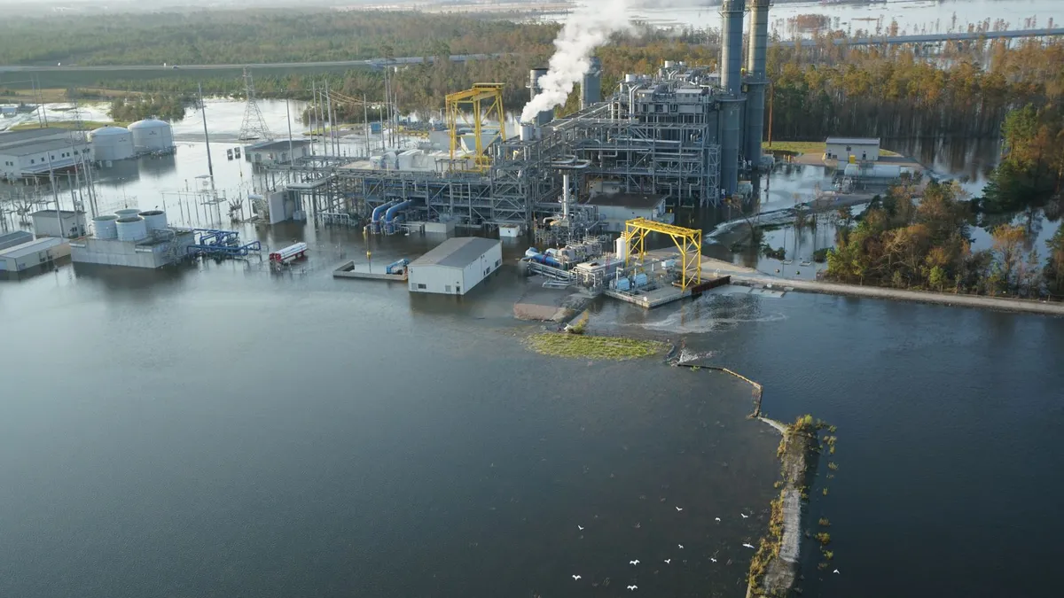
Several sites omit critical information in their CCR compliance reports, including full ground monitoring, source tests where pollution is found and predictive modeling to study the impact of potential long-term contamination. Additionally, three sites are located on flood plains, of particular concern since Hurricane Florence flooded a Duke Energy coal ash pond in September, causing the release of more than 2,000 cubic yards of ash.
Yet another site mirrors the conditions of the Dan River spill, when a drainage pipe under a pond burst. Under the current closure plan, Plant McDonough's pond would sit 50 feet away from a 46 year old corrugated metal pipe.
"That has had an impact on that proposed closure because they have an unlined basin sitting next to a corrugated metal pipe that will always have to be maintained for perpetuity in order to not fail and cause erosion problems, or corrosion of that pipe and a failure of that pipe," Chris Bowers, senior attorney at SELC told Utility Dive. "That's a problem when you've got a permanent disposal site next to a non-permanent subterranean drainage system … The CCR rule as it stands now only has a 30 year post closure care and monitoring system, which begs the question, who is responsible for maintaining that pipe after the post closure period ends?"
Finally, several sites sit on critical groundwater recharge areas, which are protected under state law because they are one of the primary areas for groundwater to flow back to an aquifer in the hydraulic cycle. Under Georgia law, those sites are protected and solid municipal waste is prohibited in those areas, unless it has a liner. Georgia Power's plan would leave ash unlined at that site, which environmentalists say seems obviously against state law.
"It makes no sense to prohibit a household garbage landfill in these protected areas without a liner and leachate collection system, on the one hand," said Bowers. "And on the other hand, issue a permit for a company to have unlined disposal pits submerged in groundwater in the same protected zones."
| Plant Site | Tons/Acres | Concerns flagged by report |
|---|---|---|
| Scherer Plant | 15.7 million tons, 776 acres |
The plan would leave ash 75-85 feet underground on a delta fed by Berry Creek, a perennial stream which will permeate the basin "in perpetuity," according to the report. The area is also within a state-designated groundwater recharge area and a floodplain. Downgradient reports find high concentrations of cobalt, boron and sulfate, but the utility has not done the proper sampling to find the source of those pollutants, according to the report. |
| McDonough Plant | 4.9 million tons, 23 and 43 acres |
The plan would combine the two ponds. Data from the report finds those ponds are up to 50 feet higher than the opposite creek bed, and groundwater flows through the basins toward unnamed streams "or directly to the Chattahoochee," according to the SELC letter. Concentrations of arsenic, beryllium, cadmium, sulfate, selenium and total dissolved solids "above health standards" have been detected but there has been no further reporting on the magnitude of the pollution. |
| Yates Plant | 12 million tons, 285 acres |
The plant sits in a state-protected recharge region and would remain unlined and covered by a soil layer, which the report finds insufficient for protecting against groundwater. There is also insufficient reporting on groundwater impacts and no system in place to prevent the heavy metals from leaching out. Well monitoring finds high concentrations of beryllium, boron, sulfate and other contaminants. |
| Hammond Plant | 1.1 million tons, 25 acres |
Groundwater flows through the ash toward nearby wetlands and creeks and capping the pond is expected to have minimal impact on that flow, according to the report. The utility failed to predict how downstream quality may be impacted or how much ash will remain submerged under groundwater post-closure. The pond is also located on a 100 year old floodplain. |
| Wansley Plant | 14.2 million tons, 343 acres |
97 feet of coal ash bury a creek at this site and the proposed plan would leave the ash 80 feet under the groundwater table. The plant is also located on a floodplain. The plan lacks a hydrology plan to predict the flow of water and ground monitoring accuracy may be off because the utility failed to place wells in "critical locations," such as in soil downstream from the site. |


